Fogo 1858
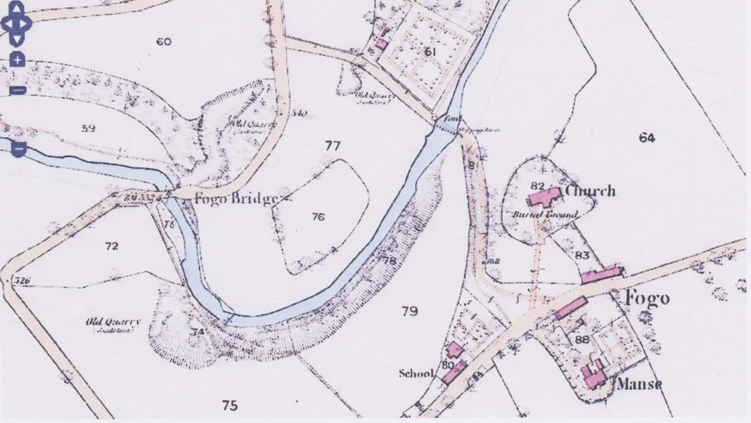
1858 MAP OF FOGO
Section of the 1858 Ordnance Survey 1:2500 map of Fogo showing Enclosure 76 to the west of Fogo Church on the other side of the Blackadder Water. Trees are clearly marked on the boundary.
Before the Fogo Bridge was built in 1641, the only route from Fogo to Duns would have been via the ford and stepping stones across the Blackadder Water.
A new footbridge was built in 2004 over the original ford to replace an earlier one destroyed by floods. Other than this footbridge and a new school built close to the one marked on the map, there have been few changes since 1858.
Enclosure 76 is not marked on OS maps from 1900 onwards.